a geographic map
The Geography of Brunant is quite varied despite the small size of the country. Brunant is located in the western Mediterranean Sea, near France and Spain. Brunant is located to the north of Menorca and about 120 miles east of Barcelona.
Political geography
Brunant cities
Brunant is divided into administrative divisions called Parishes, of which there are 12. Brunant further includes a small overseas territory called Berrio.
Geography by region

Central Island
Cape Cross
See also: Geography of Cape Cross Parish
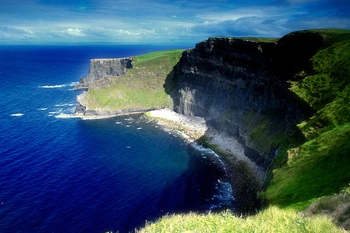
Cape Cross Parish is characterized by a variety of geographic regions. It has majestic coastal cliffs and beaches forming the coast (the town of Brezonde is located along the coast here. The city of Cape Cross (the parish capital) is found in a small valley along the northern coast. These high coastal areas lead inland to a small but mountainous region containing the some of the country's tallest peaks, including Mount Hargreaves and the Prinsenberg This area is also home to two spectacular mountain lakes, Lake Grisant and Lake Gelsant.
National capital region
Koningstad and Dortmund (divided by the Dortmund River) are found in the south of Cape Cross. This area is the most densely populated metropolitan region in the country, with a combined population of about 180,000 people. This area forms the financial and political capital of the country.
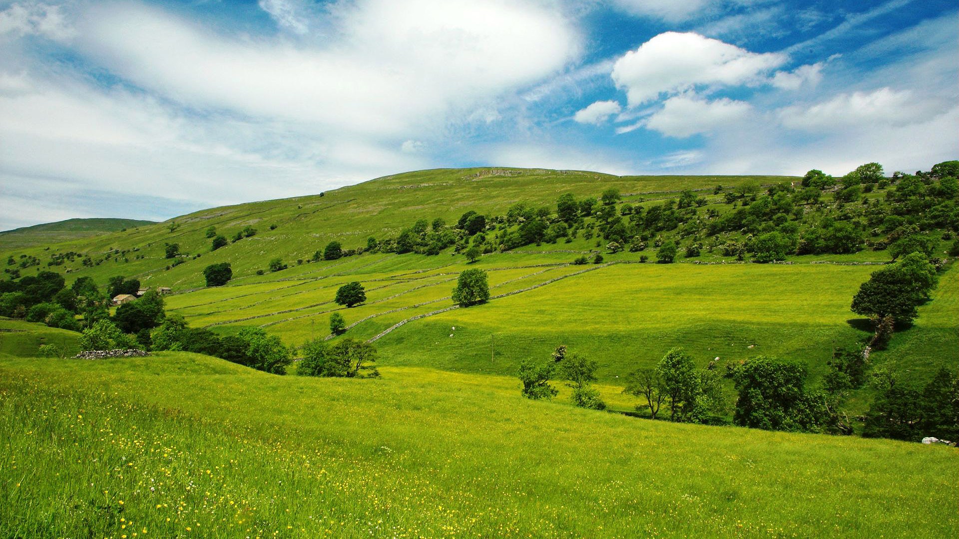
Northern plains
Much of Cape Cross, Central and Carrington Parish are characterized by flat, open plains. This area is known for being the breadbasket of the country, producing 85% of the wheat and grain supply of Brunant. To the south (especially the South-west) the area gets steeper and full of trees and hills. This area is not very populated; many large farms can be found here though.
Central ranges
The middle of Central Island is characterized by a large mountain range. This range extends from the center of Sint-Willemstad Parish and extends all the way to nothwest Helmond Parish (crossing through Central and Mariaberg Parishes along the way. This range divides the island into two, and has been a major factor in the development of the island. The Raspenberg (Raspy peak, at 1680 m), the tallest mountain in the country, is found in Central Parish. Transportation in this mountainous region is difficult, since most roads traversing the peaks are winding, steep and often dangerous. This area is not very populated, only the town of Boguestown (on the east side) and the unincorporated village of Berganz are settled in this area. These mountains are the source of the Martiges and Red River, Brunant's longest rivers, as well as its largest lake.
Rose Island
Rose Island and the parish are centered around Rosetown. It is located in a wide valley and is the main settlement in the island. Around it there are some farms, noted for their apple orchards and fruit growing.
Brunant Island
Brunant Parish has only one major town, Brunantstad and the tiny hamlet of Martensdorp.
Middleton Island
Middleton Island is generally flat apart from the region around Middleton, located on a hill.
Hogeberg Island
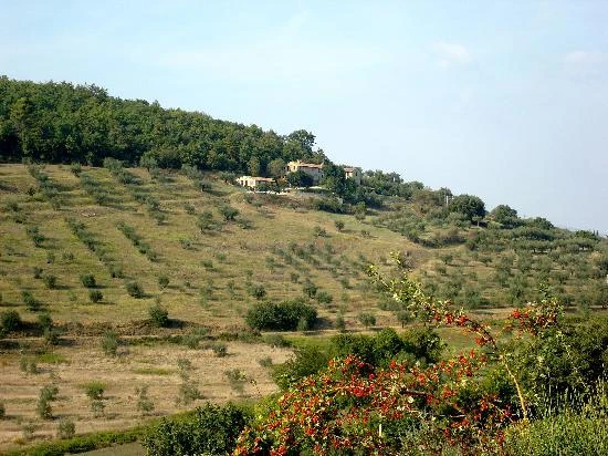
Hogeberg Island is a much different geography than all the other small islands. Both Chester and Sint-Anders Parish are characterized by rolling hills. The central region of the island is the Chester Valley, characterized by its valleys, where olive farms and wineries ae found, aided by the gently sloping topography. Grijzestad, the most populous city in the island, is found at the flatter center-east overlooking a bay.
Berrio
Berrio is comprised of the Island of Berrio and a small islet called The Rock. Berrio is dominated by the 1002 meter tall Francesca Peak. The Rock is home to Green-footed boobies.